These are quick snippets of a few current research projects and my past dissertation work.
Many thanks to my mentors and collaborators, especially my PhD advisor Roman DiBiase, MS advisors Doug Burbank and Bodo Bookhagen, senior thesis advisor Eric Kirby, and current postdoctoral mentors Seulgi Moon and Leonard Sklar.
Anything unclear on these pages is my doing... and doesn't reflect the outstanding support and caliber of their work!
Exploring the deep!... (Where does weathering begin?)
I am a part of a cross-institutional research project that studies how the earth's "critical zone" responds to differences in underlying bedrock properties (geochemistry, fracture density, physical strength).
The "critical zone" is the near-surface region on the earth that lies between fresh unweathered bedrock below, and includes weathered saprolite, soil, and the tree canopy above.
Maybe think about it as an open-faced sandwich of life?... with fresh bedrock as the bread, and the soils, plants, and life as the toppings... if you change the bread to a croissant, you might get a totally different sandwich!?
Feel free to follow the project's page on twitter to get updates! (@BedrockZone) It's a great working group!
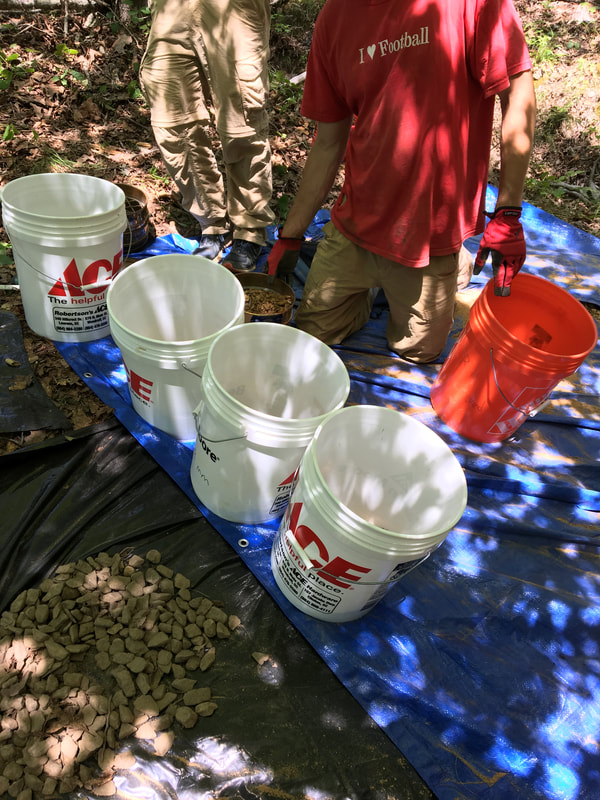
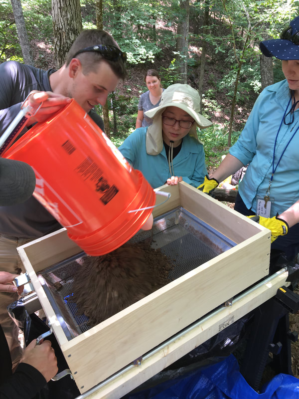
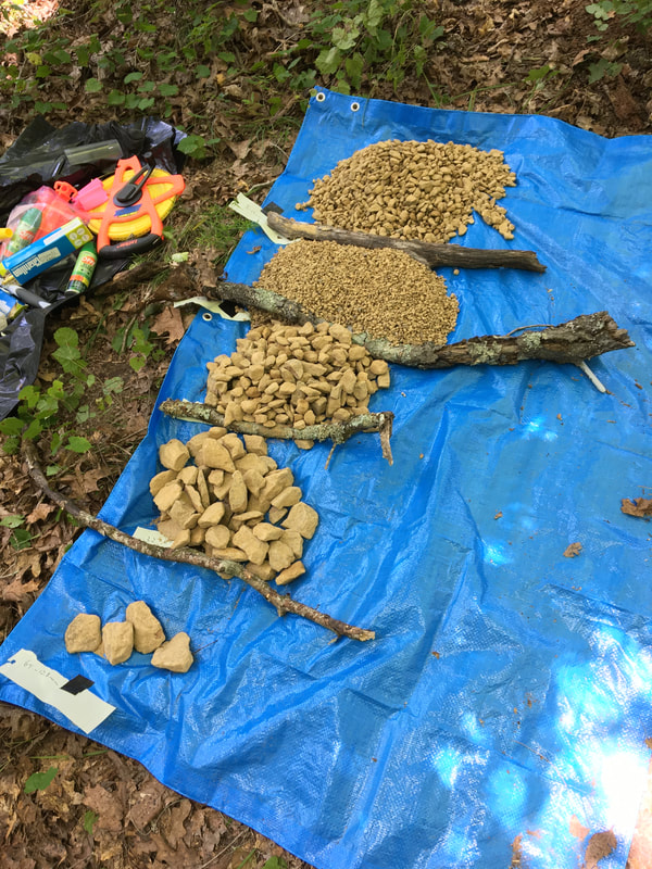
We recently had an 8-week field season at the South Carolina Piedmont CZO site at Holcombe's branch watershed and the Panola Mountain watershed in Georgia. Much more on twitter, but just a snippet below:
Some pictures show our set up to field-sieve rock fragments, with the goal of understanding how changes in underlying bedrock affect the size distribution of sediments produced. These measurements will be paired with geochemistry data from open-faced trenches & samples, near-surface geophysical measurements, and near-surface stress-modeling calculations. Exciting stuff is in the works!
The "critical zone" is the near-surface region on the earth that lies between fresh unweathered bedrock below, and includes weathered saprolite, soil, and the tree canopy above.
Maybe think about it as an open-faced sandwich of life?... with fresh bedrock as the bread, and the soils, plants, and life as the toppings... if you change the bread to a croissant, you might get a totally different sandwich!?
Feel free to follow the project's page on twitter to get updates! (@BedrockZone) It's a great working group!
We recently had an 8-week field season at the South Carolina Piedmont CZO site at Holcombe's branch watershed and the Panola Mountain watershed in Georgia. Much more on twitter, but just a snippet below:
Some pictures show our set up to field-sieve rock fragments, with the goal of understanding how changes in underlying bedrock affect the size distribution of sediments produced. These measurements will be paired with geochemistry data from open-faced trenches & samples, near-surface geophysical measurements, and near-surface stress-modeling calculations. Exciting stuff is in the works!
Landscape response to wildfires (El Dorado Fire, Yucaipa Ridge, CA)
Post-fire debris flows are a major hazard in dry, steep-sloping mountain ranges in Southern California (USA). Steep hillsides with dense, dry vegetation cover can lead to high severity fires. Moreover, steep forested terrain is often located adjacent to densely populated urban areas, increasing the danger of post fire debris and mudflows.
In 2020, a fire was started by a malfunctioning smoke machine used in a gender reveal celebration. The fire burnt ~25 square kilometers of forest across steep terrain in the San Bernardino Mountains that our group was previously researching in 2018. The fire was traumatic, causing a fatality, damage to homes and displacement of residents, 60 million dollars in projected damage costs, and imminent post-fire debris flow concerns in towns downslope.
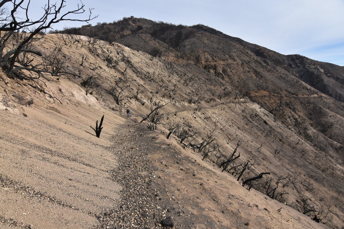
We have been collaborating with private land owners to take repeat photographs of regions studied in 2018. Photos have been taken approximately every month since the fire was contained in November of 2020.
In 2020, a fire was started by a malfunctioning smoke machine used in a gender reveal celebration. The fire burnt ~25 square kilometers of forest across steep terrain in the San Bernardino Mountains that our group was previously researching in 2018. The fire was traumatic, causing a fatality, damage to homes and displacement of residents, 60 million dollars in projected damage costs, and imminent post-fire debris flow concerns in towns downslope.
We have been collaborating with private land owners to take repeat photographs of regions studied in 2018. Photos have been taken approximately every month since the fire was contained in November of 2020.
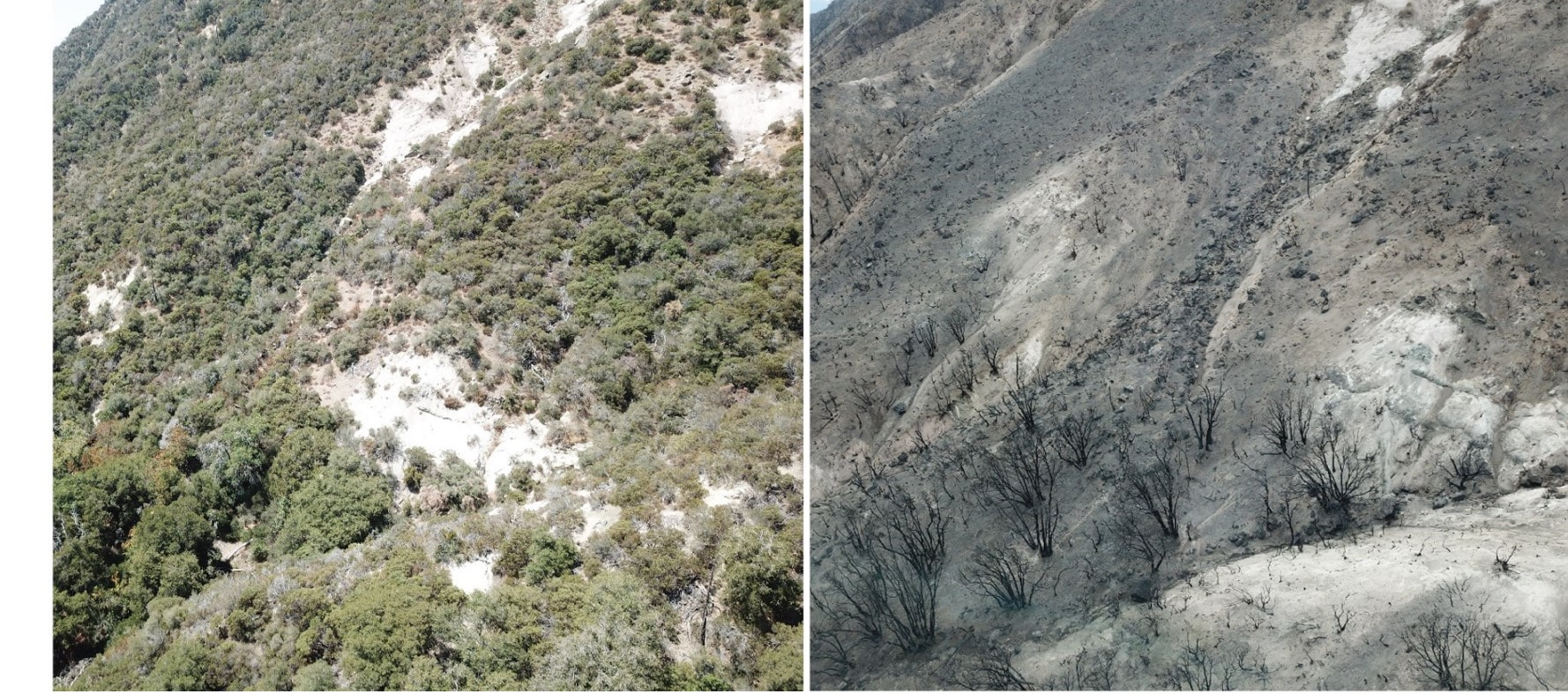
Severely burned hillside on Yucaipa Ridge (left - Sept. 2018, right Nov. 2020)
Although this research project was not originally planned, we have been using repeat photographs from 2018, 2020, and 2021 to track the grain size and volume of sediment dislodged from behind burn vegetation.
Sediment released from severely burned hillsides accumulates on forest roads (south side of Yucaipa Ridge, Nov. 2020)
Fortunately, winter precipitation has fallen as snow at these altitudes, but this landscape remains very dangerous and unpredictable.
We're detailing changes in the size distributions of sediment in steep channels impacted by the fire.
The big picture goal is to help put together a predictive framework linking topography and soil formation to the size of sediments that might exist in these upland source areas. These factors can be important when predicting the storm sizes needed to initiate debris flows.
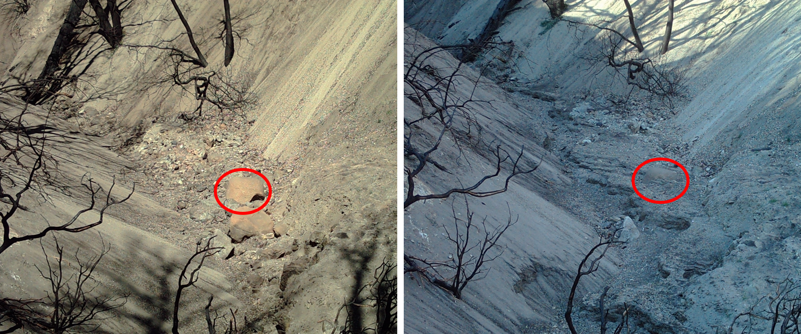
Small channel with drainage area of 0.5 sq. km filled with post-fire sediment. (left) 1/24/21, (right) 3/1/21 following snow melt. Circled clast is 80 cm across.
Analyzing bedrock fracture spacing controls on erosion, sediment transport, and the morphology of steep mountain ranges
Ph.D. project completed with Roman DiBiase at Penn State University
Ph.D. project completed with Roman DiBiase at Penn State University
Publications:
Neely, A.B. and DiBiase, R.A., 2020. Drainage area, bedrock fracture spacing, and weathering controls on landscape‐scale patterns in surface sediment grain size. Journal of Geophysical Research: Earth Surface, p.e2020JF005560. https://doi.org/10.1029/2020JF005560
Neely, A.B., Loucks, E., Carr, J., Del Vecchio, J., Greenberg, E., and DiBiase, R.A. (2020). Bedrock cliffs in the San Gabriel and San Jacinto Mountains, California. Distributed by OpenTopography. https://doi.org/10.5069/G96H4FKG
Neely, A.B., DiBiase, R.A., Corbett, L.B., Bierman, P.R., Caffee, M.W., (2019). Bedrock fracture density controls on hillslope erodibility in steep, rocky landscapes with patchy soil cover, southern California, USA
Earth and Planetary Science Letters https://doi.org/10.1016/j.epsl.2019.06.011
DiBiase, R.A., Rossi, M.W. and Neely, A.B., 2018. Fracture density and grain size controls on the relief structure of bedrock landscapes. Geology, 46(5), pp.399-402. https://doi.org/10.1130/G40006.1
Overall, the above publications explore how changes in bedrock fracture density affect the shape of mountain ranges, how quickly they erode, and the size of sediments contributed to rivers.
We paired structure-from-motion multi-view-stereo (SFM-MVS) photogrammetry techniques with aerial lidar point clouds to measure the spacing and orientation of fractures at the landscape scale. It involved a lot of hiking and over 100k photographs!
If you have questions or want to chat about SFM-MVS I'm always interested to chat about your experiences!
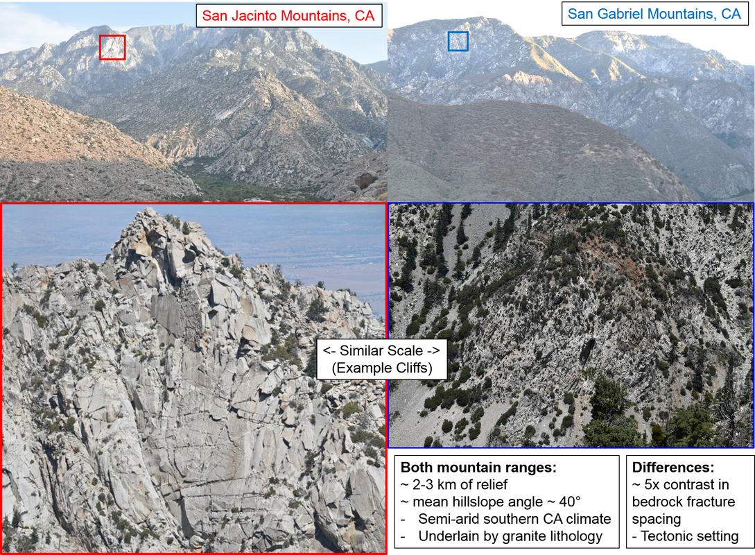
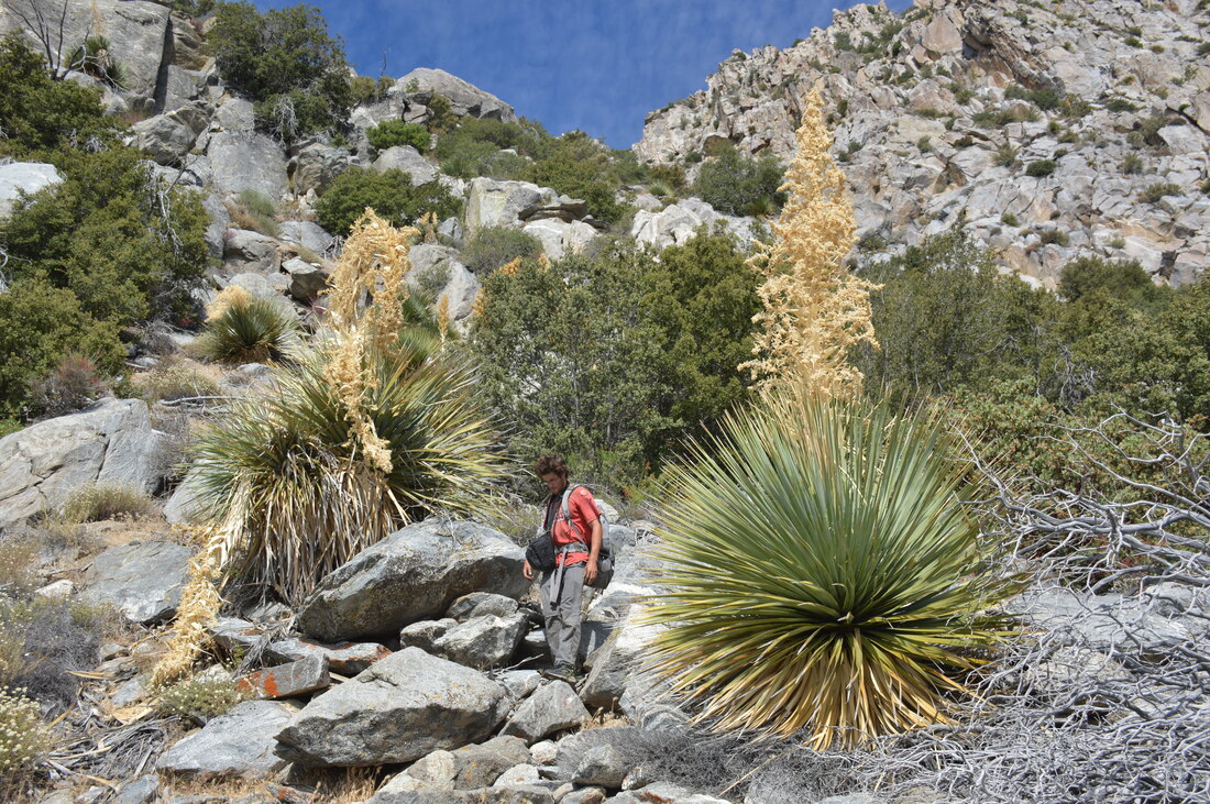
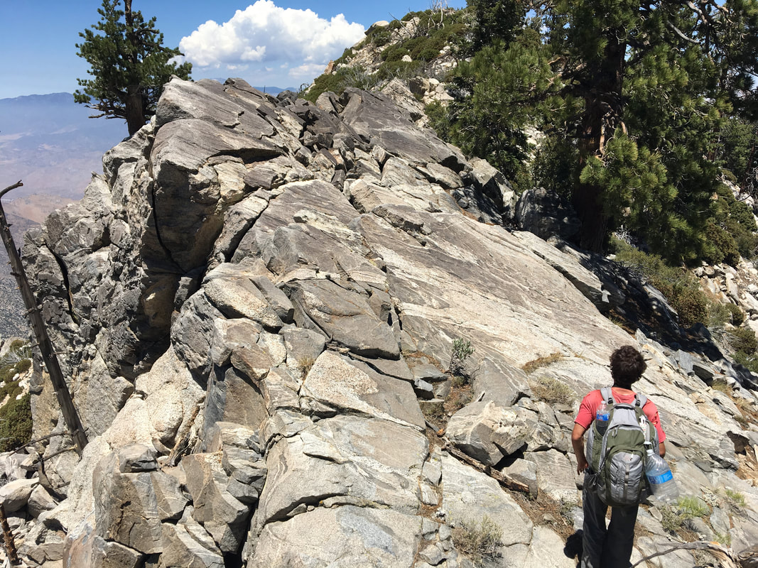
Field photographs from two study ranges in Southern California: (left, North San Jacinto Mountains), (right, San Gabriel Mountains). Bottom photographs show example cliffs from each landscape and the difference in bedrock fracture spacing that results from contrasting tectonic histories of these two ranges.
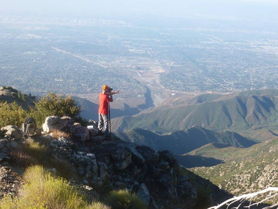
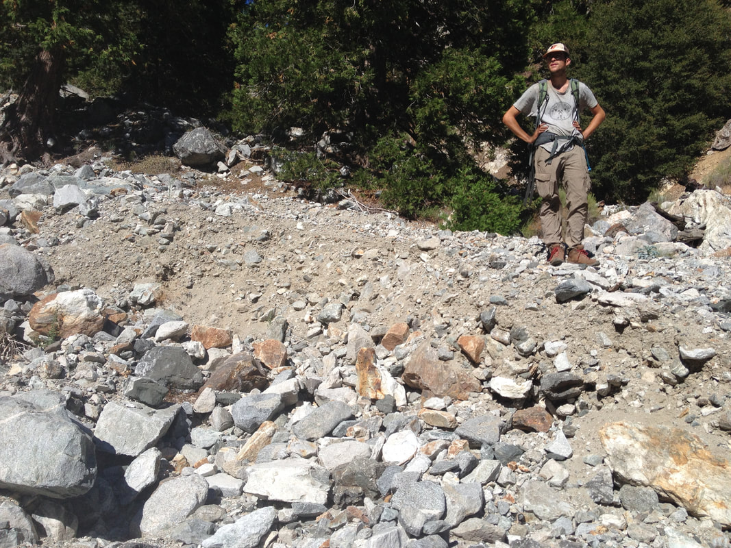
Collecting photographs of bedrock cliffs from ridgelines that overlook east Los Angeles (San Bernardino County)
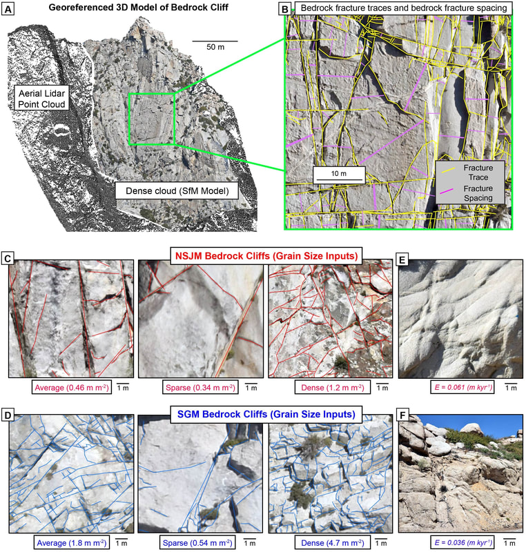
3D models of bedrock cliffs reconstructed from field photographs are used to trace bedrock fracture networks and measure fracture density and spacing
We trace the grain size of sediments produced from fractured cliffs to mountain front fans.
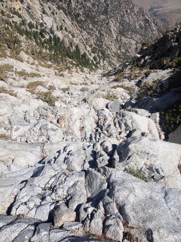
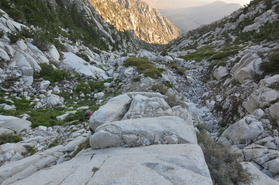
Bare-bedrock steep headwater channel chute -- the source area of destructive debris flows, San Jacinto Mountains, CA